Testimonial
Preparing for the Inevitable: Earthquake Management and Risk Mitigation in Peru
Peru resembles a beautifully stitched quilt, it’s patchwork is weaved together by the country’s coastal desert, Andes mountain range and Amazonian rainforest. However, directly beneath this natural beauty lies the boundary between the Nazca and South American tectonic plates. These plates are in constant collision with each other, making Peru subject to high seismic activity, commonly known as earthquakes. Peru is known to have over 200 minor earthquakes on average each year, and approximately one significant earthquake every six years (Dunnell, 2018).

Tectonic Plates in the World. Retrieved from http://www.limaeasy.com/earthq...
One night in January, I was woken up by the aggressive rattling of my bed and the sound of clatter as my personal belongings began to fall off my dresser and onto the floor. This was not the first time that I have felt the ground moving beneath me since my arrival to Ica, Peru, however, it was certainly the strongest. Later that day, the United States Geological Survey (USGS) website, a US-based agency devoted to providing science on natural hazards that threaten lives and livelihoods around the world, released details on the earthquake I experienced. Their records stated that the event measured a magnitude of 5.6 on the Richter Scale, classifying it as a moderate size earthquake. An earthquake of this magnitude is known to cause slight damage to buildings, however, the National Civil Defense Institute (INDECI) of Peru, a government branch responsible for emergency and disaster response and rehabilitation, declared that no personal or material damage was recorded in the region of Ica that night (INDECI, 2019).
INDECI concluded its statement by reminding their readers that earthquakes are a reoccurring and dangerous natural phenomenon in Ica, and precautions should be taken in the case of another unpredictable, moderate or higher level earthquake. Reading this motivated me to brush up on the history of earthquakes in Peru (and in the state of Ica in specific), and investigate the country’s risk prevention and natural disaster management plans.
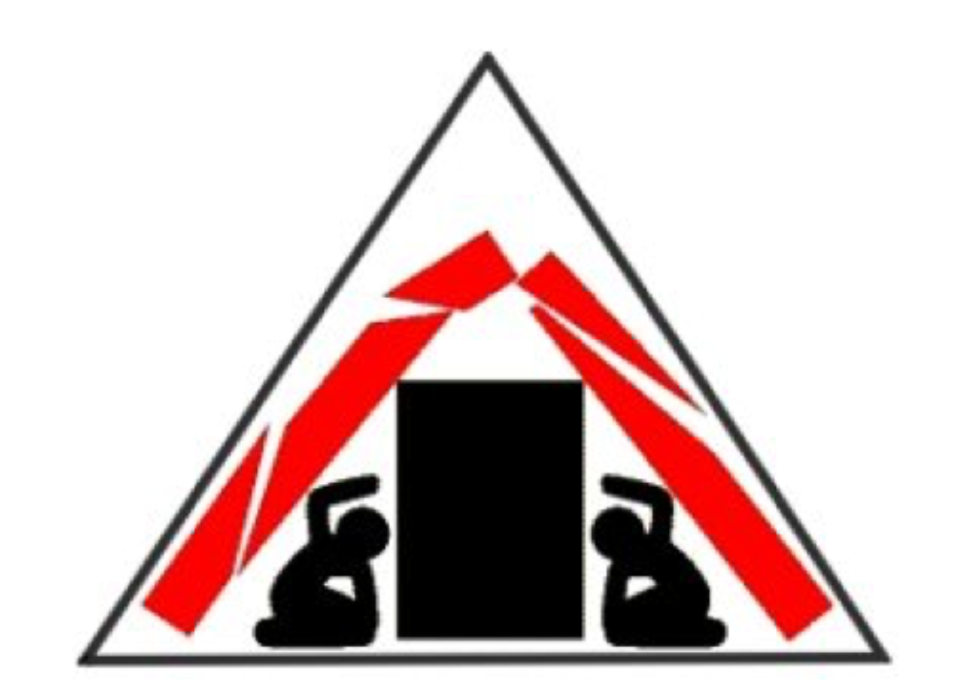
By talking with befriended Peruvians about what to do in the event of an earthquake, they all responded similarly: Frist, stay calm. Second, when at home, move to safety away from windows and remain close to main building columns. My neighbours offered further advice, suggesting I predetermine a safety zone with The Triangle of Life Method in mind for extra precaution. Additionally, the UNITERRA team equipped me with an emergency backpack at my arrival, which I have stored in my now predetermined safety zone in my apartment and stocked it with extra non-perishables and water bottles, as per the advice given to me by my supervisor at Horizonte Corporativo. Furthermore, a local friend mentioned that if an earthquake were to happen in public, and there is no time to get outdoors and away from buildings, one should seek refuge by pillars marked with a green and white “S” sign. She explained that these signs indicate government approved safety zones and can be found in most shops, restaurants, banks, and malls throughout Ica and Peru in general.

The Triangle of Life Symbol, recommended to keep safe in case of an earthquake. Retrieved from http://www.limaeasy.com/earthq...

Safety Zone sign used to orient people in Peru to safety in the case of an earthquake. Retrieved from http://bvpad.indeci.gob.pe/doc...
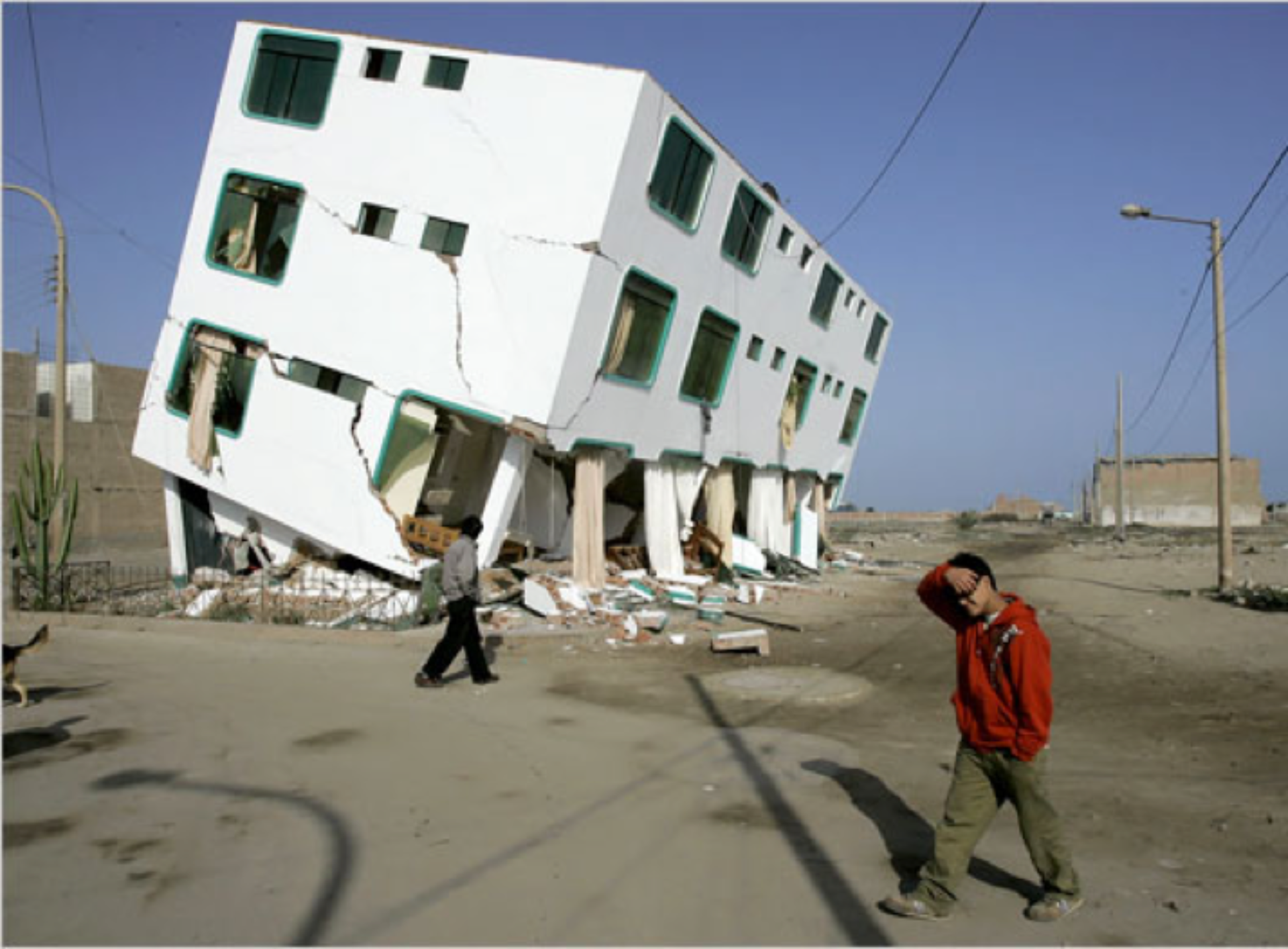
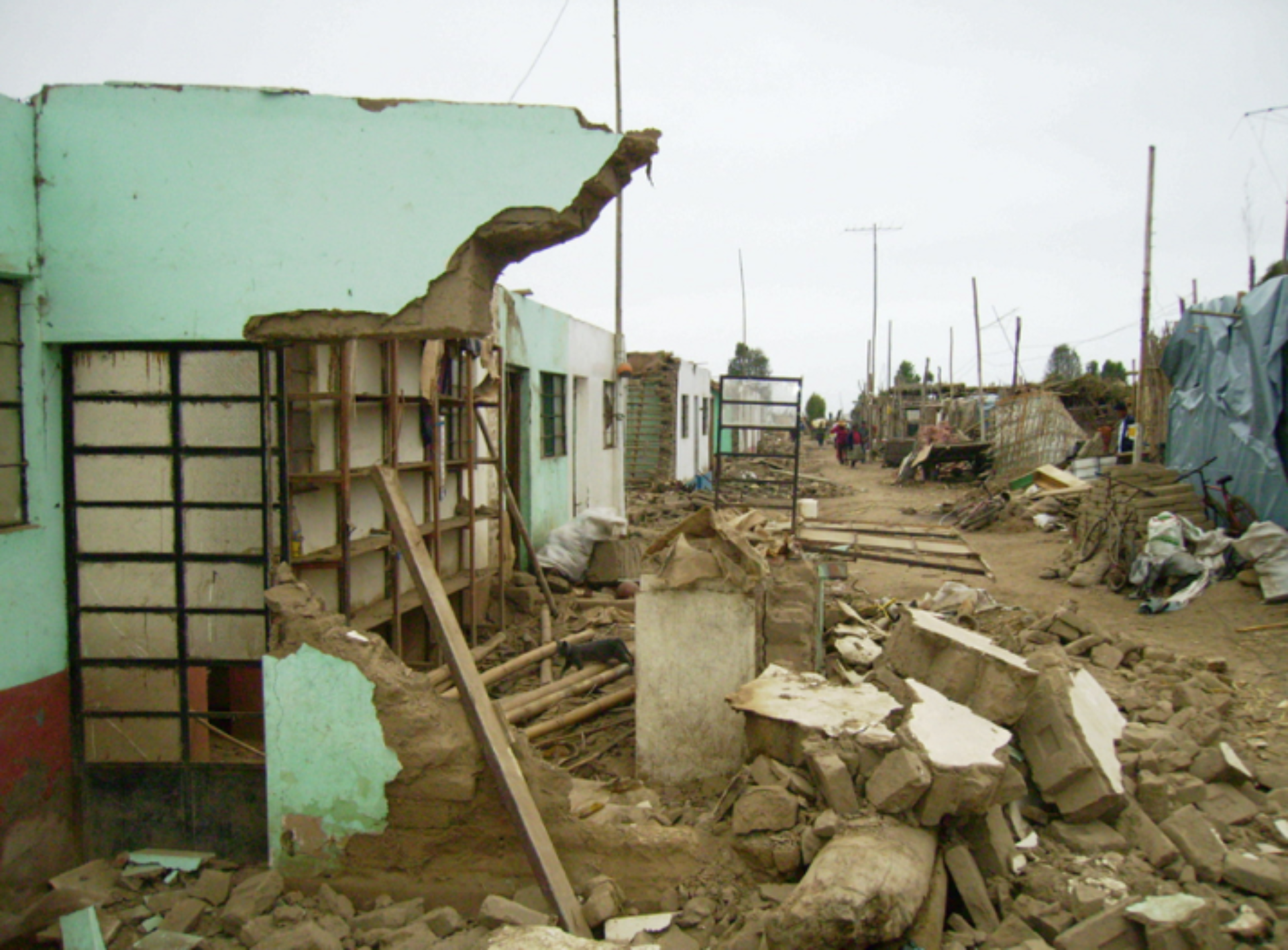
Apart from learning what Ica residents can do to ensure their own safety, I wanted to learn more about the national and local government’s role in earthquake risk mitigation and response systems. The people I had talked to about it, all mentioned they were not satisfied with the past and current systems in place. Many referenced the local and national government’s chaotic coordination and lack of capacity to protect, rescue and aid those affected by the last big earthquake that struck Ica in 2007. The earthquake reached a magnitude of 8.0, causing many buildings to collapse, and ultimately injuring over 2000 people and causing close to 600 casualties (Rapp, 2017). Since then, they expressed a lack of trust in their officials and have seen little to no advancements made to better prepare the country and its people from life-threatening earthquakes.

Collapsed building caused by the 2007 earthquake in Ica, Peru. Retrieved from https://www.nytimes.com/2007/0...

Damage to neighbourhood after 2007 earthquake in Ica, Peru. Retrieved from https://perureports.com/2007-p...
Posing the question: what has the national and local government done since the last major earthquake to prepare for the next, unpredictable and inevitable major earthquake to come?
I took this question up to the local INDECI office, which so happens to be at a short walk from my apartment in Ica. When I visited, the secretary briefed me on Congress’ significant decision to replace the Ministry of Defence’s National Civil Defense System (SINADECI) with the new National System of Disaster Risk Management (SINAGERD) in 2011. She then referred me to online sources that would deepen my understanding for the change in the system and learn more about SINAGERDs mission, vision and executions to date in response to earthquakes.
Following her guidance, I discovered that the new System shifted the Ministry of Defence’s focus from preparedness after an earthquake (such as emergency response strategies), to reducing preventable hazards before an earthquake strikes (CENAPRED, 2017).
To date, SINAGRED has made strides to move its 3-part Disaster Risk Management (DRM) approach to the forefront of their agenda. The first two components of DRM are Prospective and Corrective Management, which seek to reduce the creation of future risks and rectify existing vulnerabilities. SINAGRED has applied these two practices by establishing and enforcing an updated set of principles, policy guidelines, processes and instruments for risk analysis on land-use development plans, as well as strengthening existing vulnerable structures that otherwise would crumble at the sign of a large earthquake (Lavell, 2014). The third component, Reactive Management, minimizes the expected loss and damages associated with earthquakes. Advancements in this field include disaster response training, and developing plans to install Early Warning Systems designed to alert Peruvians of incoming natural disasters.
The creation of SINAGERD represents an important advancement in sustainable development and disaster mitigation for Peru. Contrary to popular belief, their work and accomplishments in risk mitigation and disaster preparedness indicate that Peru is better equipped for the next big earthquake. However, seeing as no major earthquake has occurred since SINAGERD’s creation, their management and system have yet to be tested.
References:
CENEPRED. (2017). Center of National Estimation, Prevention and Reduction of Disaster Risks Annual Memorial 2017. CENEPRED. Retrieved from https://www.cenepred.gob.pe/web/transparencia/opp/memoria-anual-2017.pdf
Dunnell, T. (2018). Earthquakes in Peru. Trip Savvy. Retrieved from https://www.tripsavvy.com/earthquakes-in-peru-1619788
INDECI (2019). Reporte de Situación DiariaEnero 25, 2019. INDECI. Retrieved from https://www.indeci.gob.pe/portal2019/wp-content/uploads/2019/01/20190125191509.pdf
Lavell, A. (2014). Disaster risk reduction and public investment decisions: The Peruvian Case. FLACSO. Retrieved from http://sigrid.cenepred.gob.pe/docs/PARA%20PUBLICAR/OTROS/Disaster%20Risk%20Reduction%20and%20Public%20Investment%20Decisions.%20The%20Peruvian%20Case.pdf
Rapp, J. (2017). 2007 Peru Earthquake 10 years on: Is Peru prepared for the next big one? Peru Reports. Retrieved from https://perureports.com/2007-peru-earthquake-10-years-peru-prepared-next-one/6197/
